Striped Bass
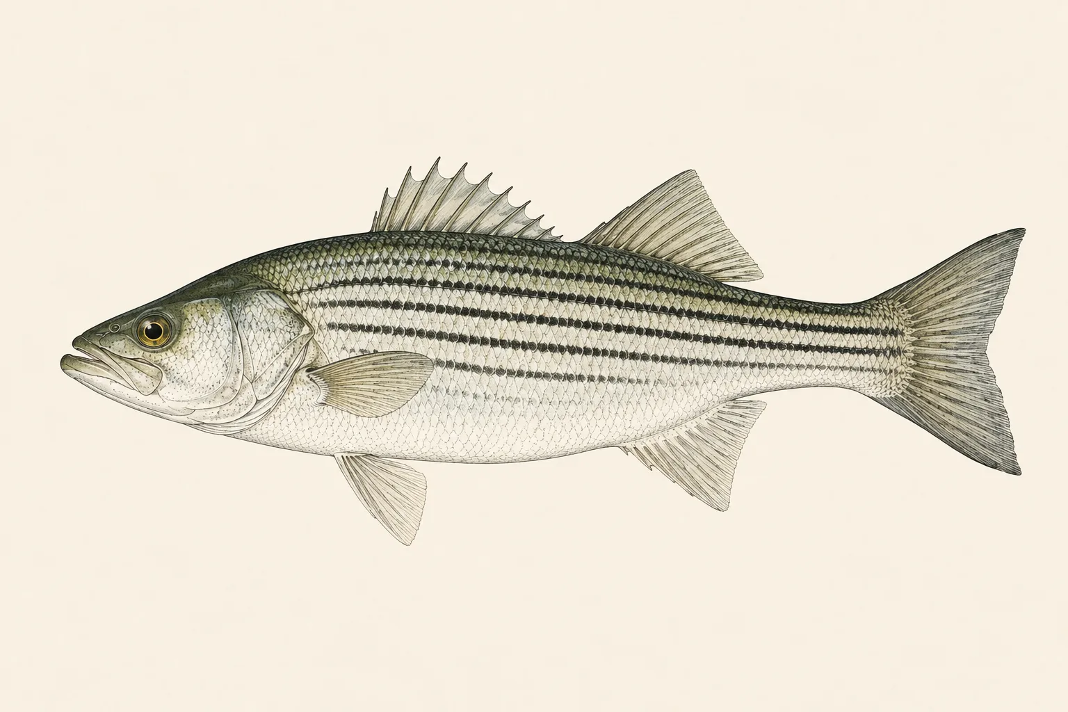
Striped Bass (Morone saxatilis) is a freshwater and saltwater species. The first thing to check: seven or eight sharp black horizontal stripes on a silver flank, most running unbroken from the gill cover to the tail. The look-alike to rule out is White Bass: white bass are far deeper-bodied, rarely over a few pounds, and have a single tongue tooth patch.
Last updated
| Scientific name | Morone saxatilis |
|---|---|
| Also called | striper, rockfish, linesider |
| Water | Freshwater and saltwater |
| Group | Temperate bass |
| Temperature | Feeds hardest between 55 and 68 °F. Coastal migrations track the 55 to 60 °F band up and down the seaboard through the year. |
How to identify a Striped Bass
- Seven or eight sharp black horizontal stripes on a silver flank, most running unbroken from the gill cover to the tail.
- Two distinct tooth patches on the tongue.
- A long, streamlined body — much less deep-bodied than a white bass or a hybrid.
If you would rather not work through a key on a wet deck, photograph the fish and let the app name it — you get the common and the scientific name back, and the record is filed before you release.
Fish it is mistaken for
| Species | How to tell them apart |
|---|---|
| White Bass | White bass are far deeper-bodied, rarely over a few pounds, and have a single tongue tooth patch. |
| Hybrid Striped Bass | Hybrid stripes are broken and offset; a true striper's stripes are clean and continuous. |
Side-by-side comparisons
Read the full entry for White Bass and Hybrid Striped Bass.
Where it lives
Atlantic coast from the Maritimes to northern Florida and the Gulf, running up rivers to spawn, and landlocked in reservoirs across much of the country. Holds in rips, structure and current on the coast, and follows open-water bait in reservoirs.
Temperature
Feeds hardest between 55 and 68 °F. Coastal migrations track the 55 to 60 °F band up and down the seaboard through the year.
The conditions that matter
For coastal stripers, tide is the single most important reading — fish set up on the down-current side of structure and feed on moving water, and the productive window on a given rip is often only a couple of hours of a given stage. Water temperature governs the migration, so a logbook holding tide stage and water temperature per catch tells you both when the fish arrive and which two hours to be there.
Global Fishing League records 18 weather and water readings against every catch automatically — tide stage, barometric pressure, water temperature, salinity, dissolved oxygen, chlorophyll, swell, current, moon phase and more, taken at your GPS position at the moment you log the fish. Over a season that turns a hunch about striped bass into a pattern you can read.
See every reading recorded with a catch, or the guides to what each reading means.
Size limits, bag limits and seasons
Size limits, bag limits, slot limits and seasons are set by your state wildlife agency — and for many offshore and migratory species by federal regulators — and on many waters they differ from the statewide rule. They also change between seasons. Check the current regulations for the exact water you are fishing before you keep a fish — we do not republish limits here, because a number that is a season out of date is worse than no number.
What the app does do is make your side of it accurate: every catch carries a length measured from the photograph, a GPS position and a timestamp, exportable if you ever need to show your work for a tournament or a record claim. It is also what a Global Fishing League entry is built from — a record that verifies itself, without publishing where you caught the fish.